Before I forget, I wanted to jot down some notes about the Parks on the Air exercises I just did in Iceland and the Faroe Islands. Final statistics: Iceland: 11 parks activated (9 the first time anyone had), 382 QSOs, 277 confirmed (as of writing) for 41 countries. For the Faroe Islands, 172 QSOs, 121 confirmed, 37 countries. I also found my 10,000th geocache.
Pre-trip preparation
- Paperwork. The ARRL is a starting point for US hams operating internationally, but their site is primarily a collection of links to documents you’re supposed to pore through and understand. The material can be exceptionally boring (T/R 61-01 zzzzzzz). The Iceland club had a nice summary, only lacking a specific link to the permit needed. (The permit was free, and quickly obtained.) There was a club for Faroe Islands, but it and the Danish authority were challenging to browse with Google Translate. I was unable to find anything specific, and hoped it wouldn’t be a big deal.
- Equipment optimization through Trial POTA activations. This was also an opportunity to work out kinks with my laptop, re-familiarized myself with the KX3, tried different antenna options, and set up a flow for logging.
- Identify potential POTA sites.
- Logging is complicated. I had a TF/WT8P from last year, and added OY/WT8P, which was “announced” and led to conversations with DX Daily (who publishes information about DX operations) and a ham who offered to manage sending paper QSL cards.
Equipment
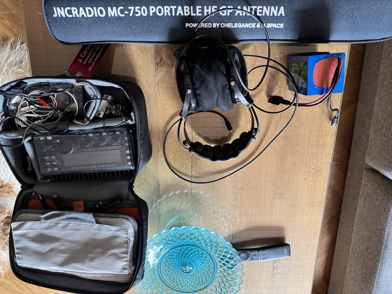
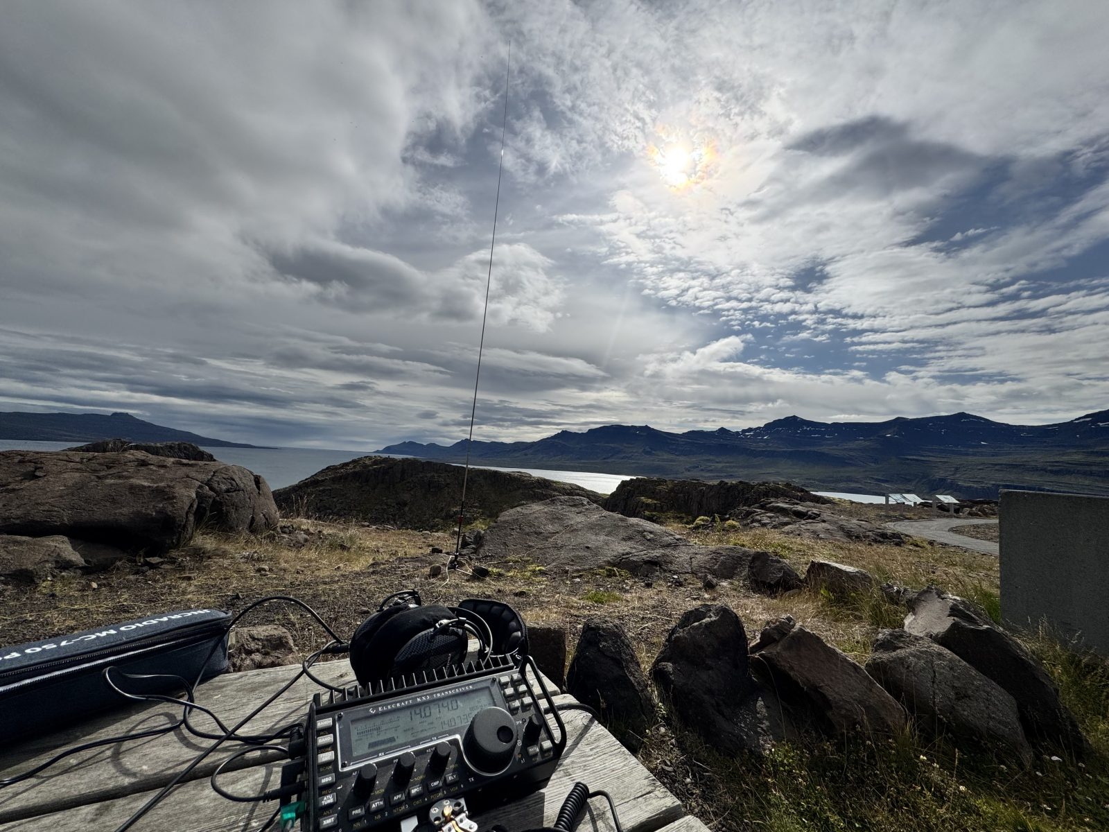
- Elecraft KX3 – this is the original radio I purchased in 2017. As I now use an Elecraft K4 as my base station, it is only used as a portable, for which it works well. However, if I were starting anew, I would look at the KX2 (smaller) or, possibly, one of the newer alternatives like the Lab599 or an Icom IC-705.
- 6Ah LiFePO4 battery (Bioenno) – I was angsting about this because it’s not a huge battery. I have a 15Ah, but it’s too large (15Ah * 12V = 180Wh) to legally take on the airline (in personal baggage). In practice, with the KX3, I can get about 3-4 hours on air, easily outlasting my bladder. This was fine for activating two parks in a day. Recharging was done after I got back to my hotel/hostel.
- Radiosport Headphones – these help filter out background noise, and I’m glad I brought them as an alternative to using the old-style iPhone earbuds and a splitter. It’s too bad there’s no Bluetooth so I can use my AirPods.
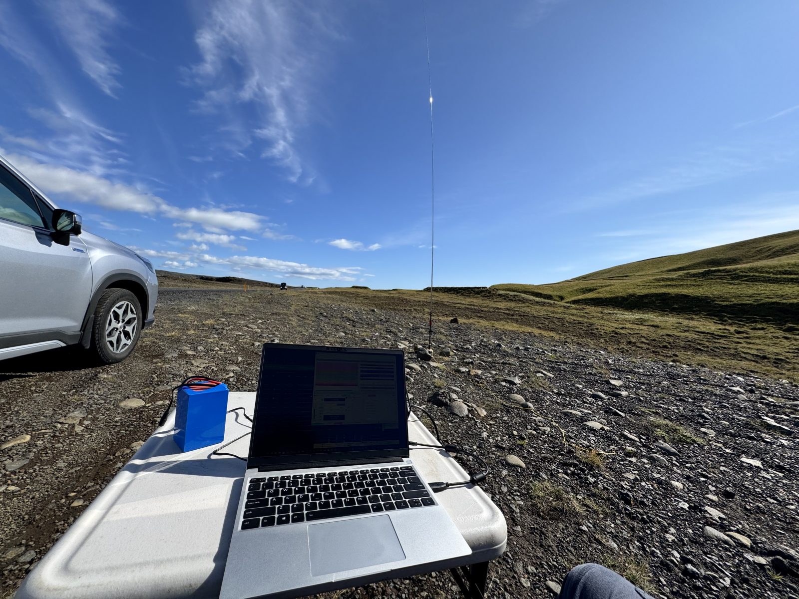
- JNCRadio MC-750 Portable Antenna. This is a vertical antenna suitable for 6m – 20m, and 30/40m with the coil. I was mindful that neither Iceland nor Faroe Islands have a lot of trees. Poking stakes into fresh basalt might be difficult, so I also had a small tripod. A 15m coax also fits within the bag.
- Digirig Mobile – this is an external sound/serial port for digital modes. It’s tiny, works flawlessly, and uses only one USB port on the computer to control the radio and drive/receive signal.
- Gear Snake. This is essentially a long, rubberized twist tie that you can cut into smaller bits. I have it in three parts and use it help tether the upper end of the antenna to signs.
- Anker PowerCore+ PD 45W power bank with charger. This was primarily as a backup to the laptop and phone power, and was used on the Holmanes and Faroe Islands activations because I was getting a lot of interest on the air. I estimate that it’s good for about one whole laptop charge.
Identifying Potential Parks on the Air Sites
The Parks on the Air website lets you browse a map by region, which is great assuming you’re familiar with the local region names. There is also an option to download a set of coordinates. Since GPX was supported, I used my old geocaching tool GSAK to load them up on a map and compare it to the map of candidate geocaches. I removed things on the West Fjords (I wouldn’t be going there this time), National parks (been there, done that), and interior of the country to come up with a few dozen candidates.
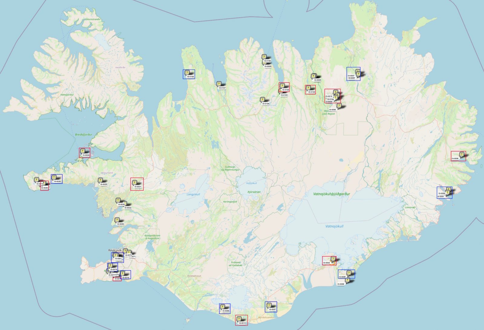
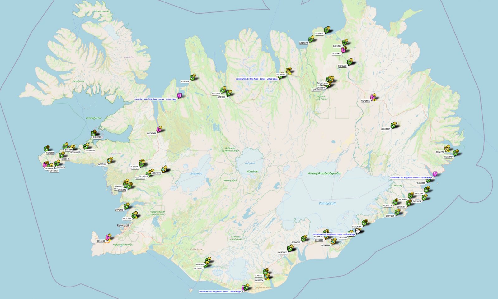
The map above is the list of Parks on the Air sites considered. Red boxes are the ones I actually activated. The other boxed ones are parks that I visited, but for one reason or another, did not activate.
Parks Activated
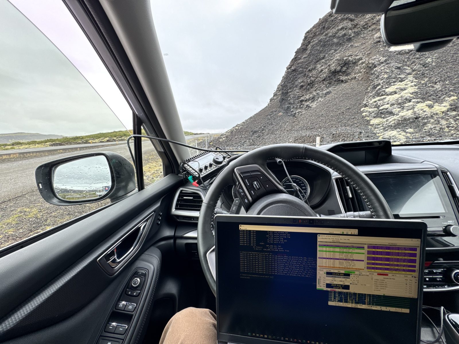
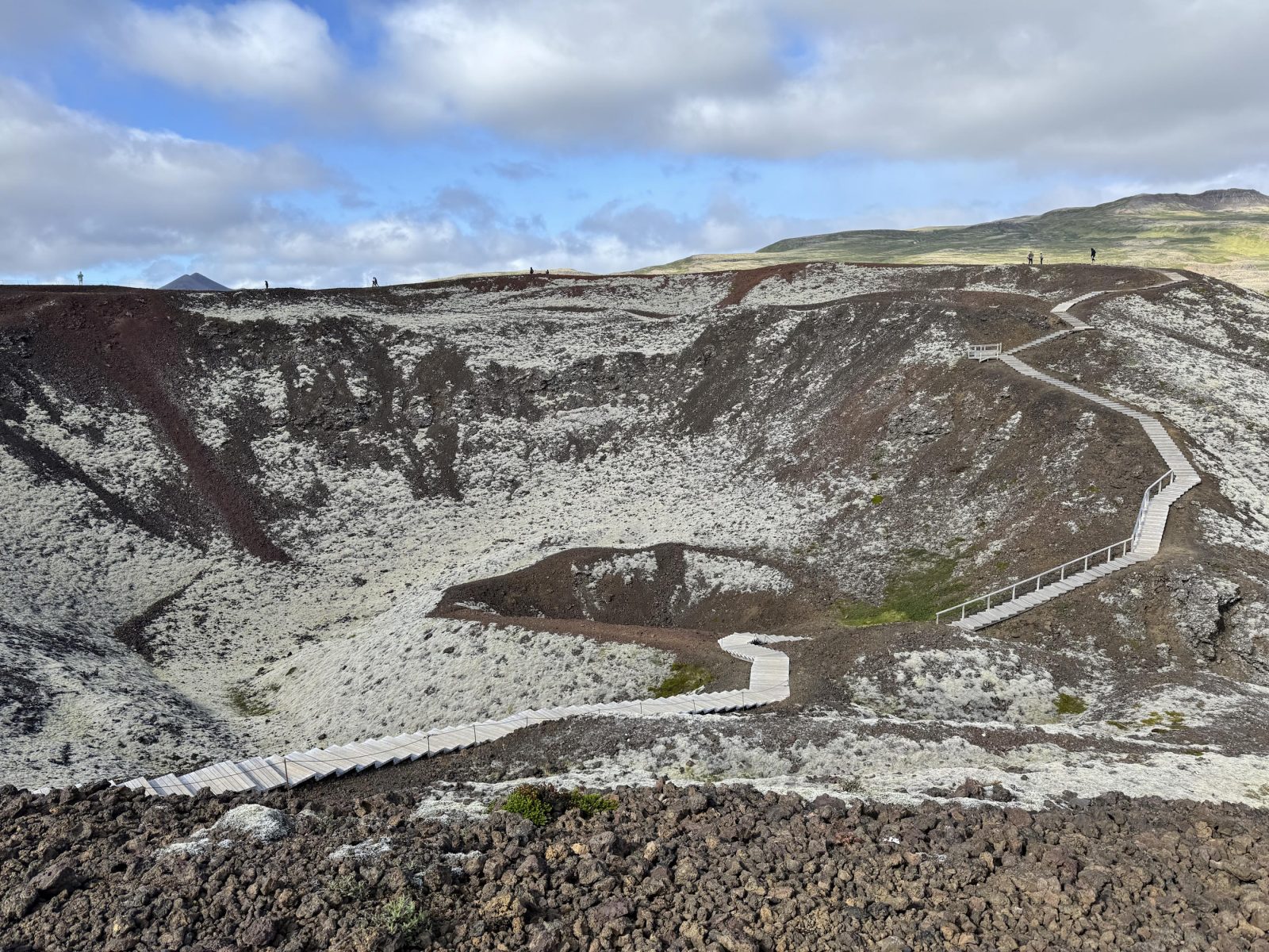
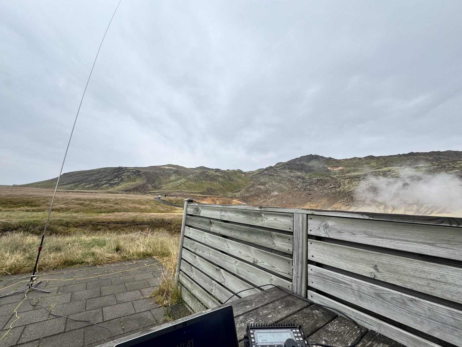
IS-0031 – Grábrókargígar Natural Monument – This is located off of Highway 1, just north of Bifrost (and close to the Hraufsnef Hotel where I was staying). There is an overflow parking lot just south of the main lot that I found it convenient to set up in. Since it was windy and a little rainy, I anchored my vertical against a fence post, and operated FT8 from inside my car.
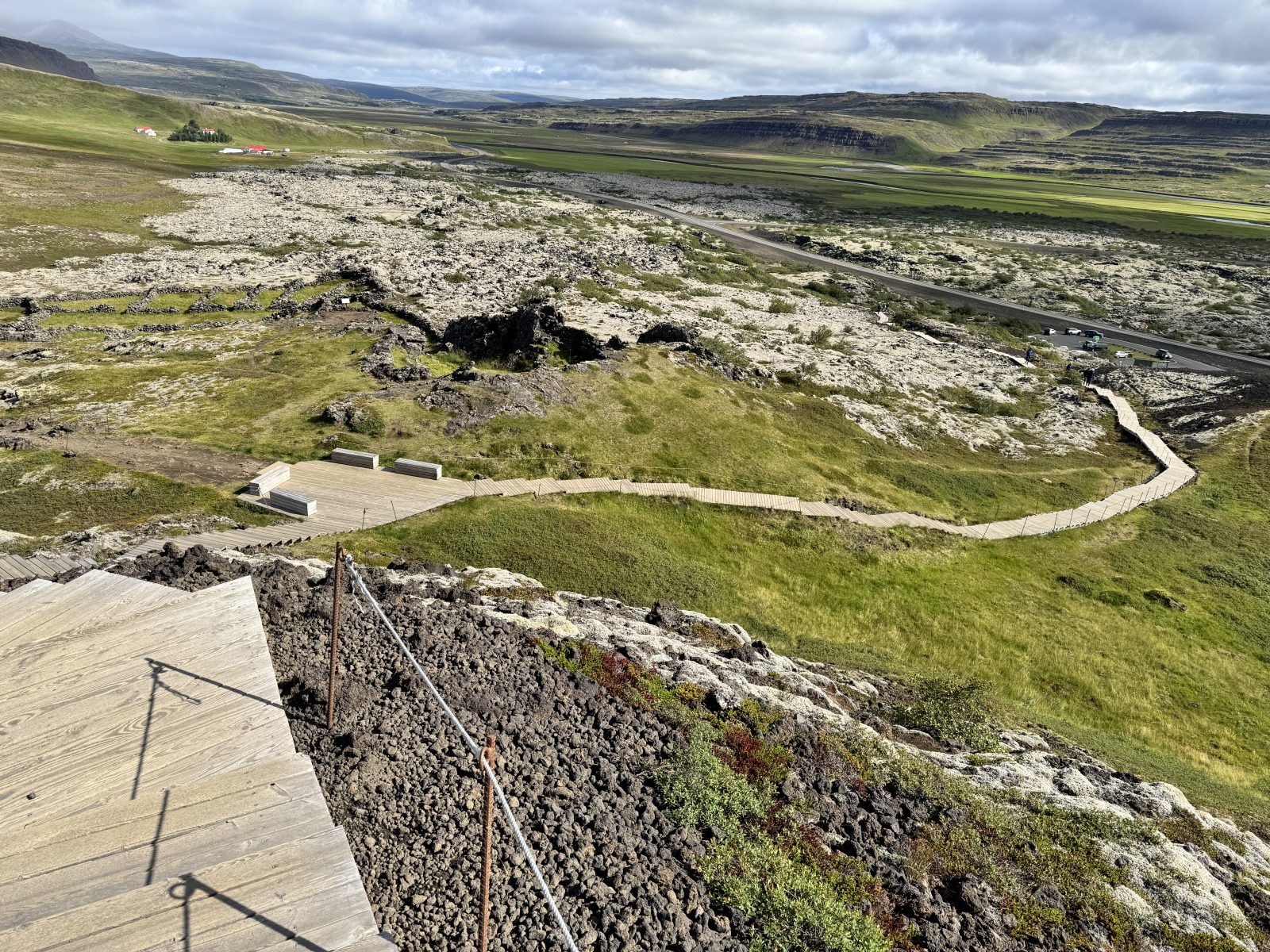
A couple of days later, the weather was much improved and I took a trip up to the top — a few hundred steps up to the trail around the caldera. Working from atop is impractical, as there’s no way to do it without being in the way. The wind was gusting over 40 knots at times.
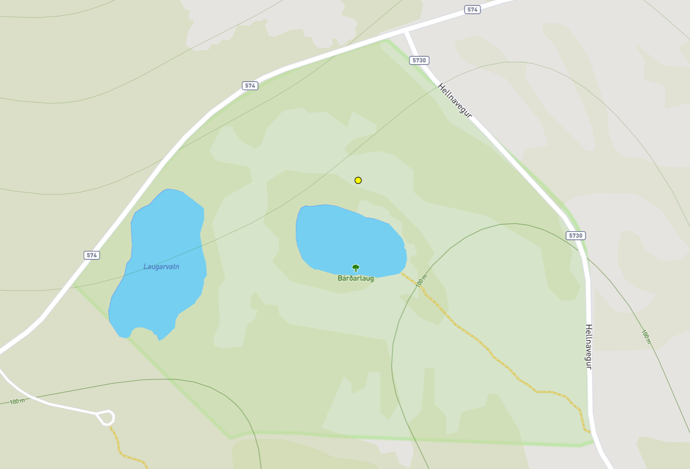
IS-0026 – Bárðalaug Natural Monument – is one of several sites on the Snaefellsness Peninsula. I was initially going to try IS-0027, but the site was busy and I’d be risking people wandering back and forth over my radials. I back-tracked, then was confused at how to get to it. I and was a little confusing how to get to it. I drove around and found a pull-out with a trail (marked by pipes) leading to the main waypoint. However, because it was wide open with a strong breeze, I went back to my car and worked from the parking lot. I anchored some of the antenna to the informational sign, ran radials and sat, shielded from the wind, in the back of the car.
It’s a very quiet area, with only one other car visiting during the time I was on-air.
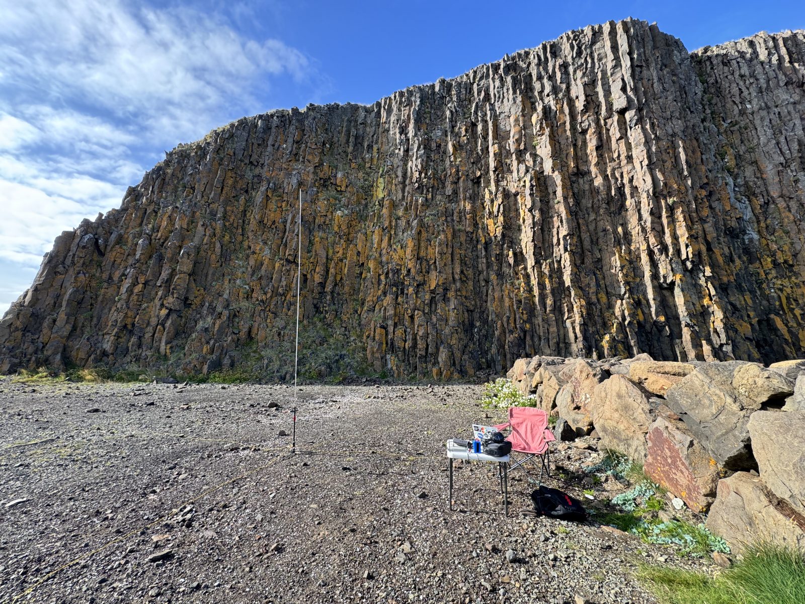
IS-0024 Breiðafjörður Protected Landscape Area – After a couple of car-activations, this was a pleasant place to get out into the sun. It’s on the northern tip of the Snaefellsnes peninsula, near a ferry dock. There was a nice gravel area in front of the basalt uplift where I could set up my table and chair, and bask in the evening sun. When I was done operating, I walked around and on top of the basalt.
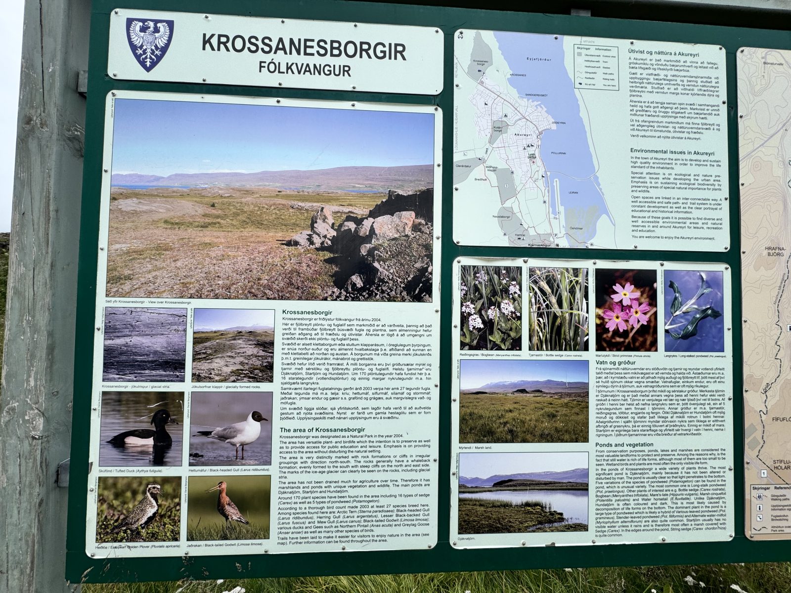
IS-0105 Krossanesborgir Country Park – On my drive to Myvatn, I initially planned on stopping at IS-0108, but it was early enough in the morning that I felt getting contacts would take a while. I couldn’t see a simple way to access IS-0104, so I continued on to Akureyri, to this wildlife viewing park north of town. After exploring the trail, I did another car-based activation. This time I sat in the passenger side (more room!).
When done, I filled up with gas and found a Bonus where I could get some snacks.
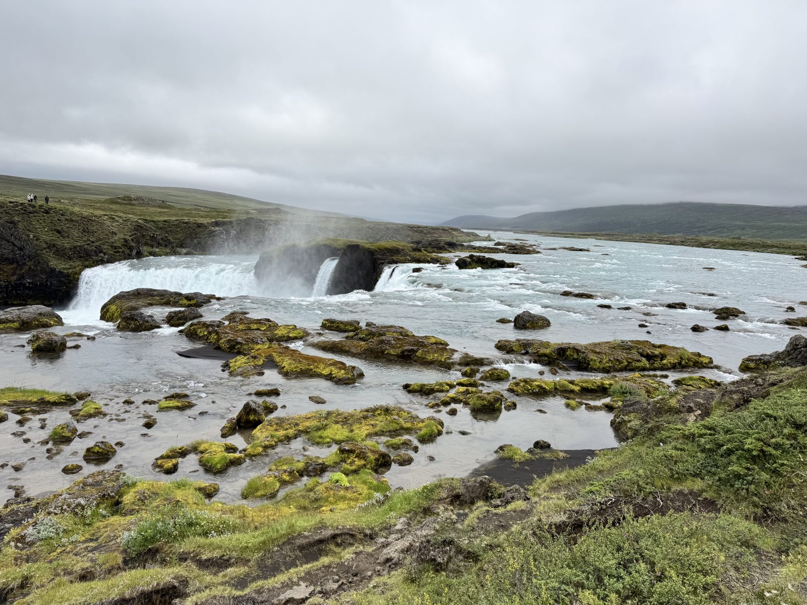
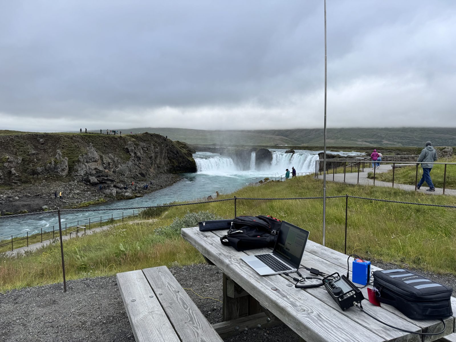
IS-0102 Goðafoss National Monument was a nice stop to walk around. On the way back to the car, I noticed a couple of picnic benches off to the side, so I grabbed my ham stuff and set up. The antenna is steadied by the picnic table, and the radials are simply tossed onto the grass. I worked from here for about 50 minutes, before a busload of tourists disembarked and people were walking like zombies into my little nook. (Note that I’m off to the side of the trail and there are far better views a short walk over.)
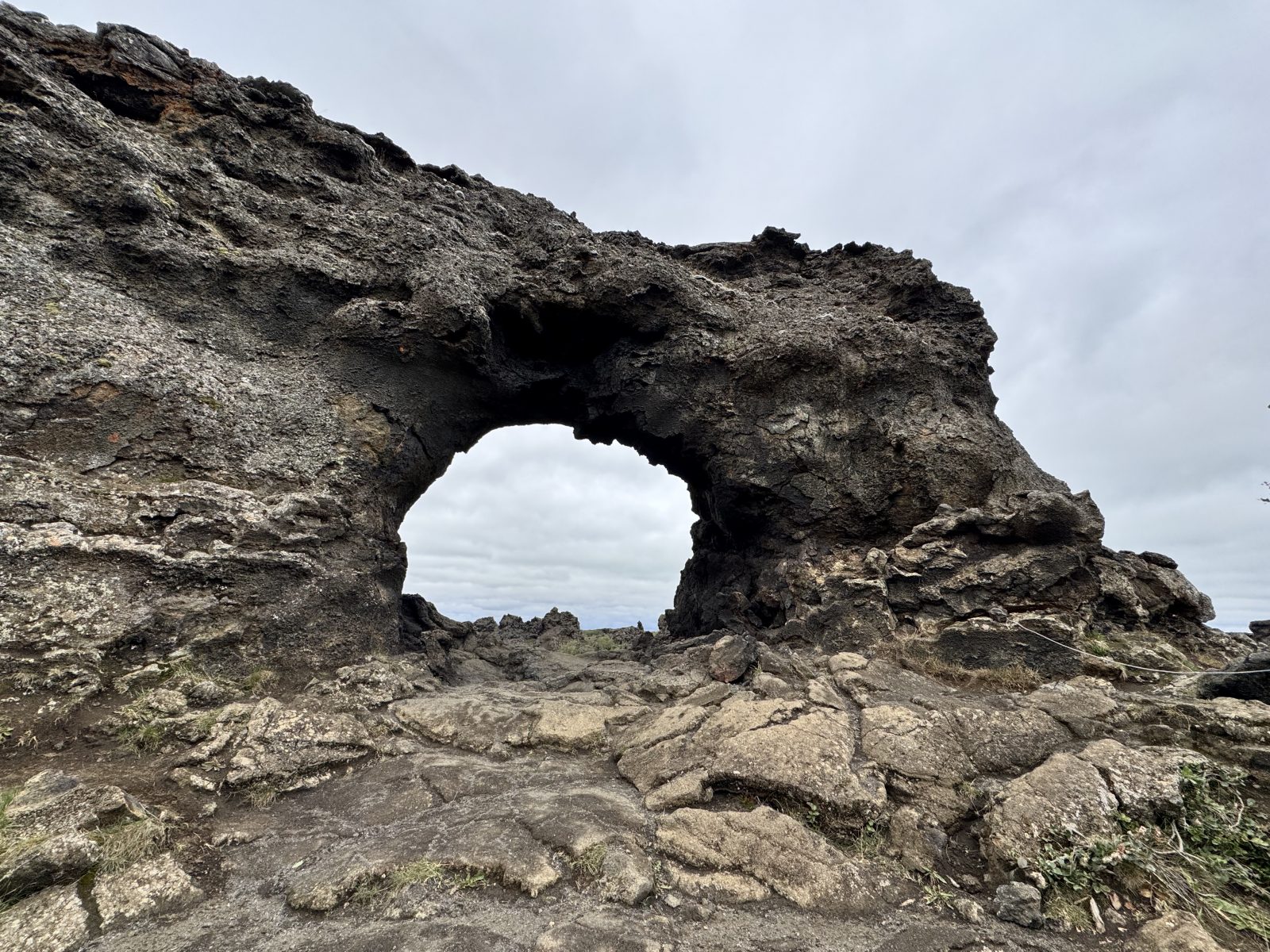
IS-0099 Dimmuborgir National Nature Reserve – this was a very fun park to hike in. They have five different loops of different distances and intensities, as well as two that take you out of the park and to the adjacent Hverfjall National Monument. I stuck with the longest inside the park and was soon off by myself.
When I was done hiking, I briefly tried driving over to Hverfjall National Monument, but that area was packed with people. I returned to Dimmuborgir, and set up my radio in the lower parking lot where I could work the 13:00 CWT event.
IS-0010 Mývatn Protected Landscape Area – This was a quick activation for the 19:00 CWT event and after I had spent some time at the Myvatn Nature Baths. It was raining, so I worked from the parking lot, sitting on the passenger side of my car. I realized that it’s the only place I hadn’t taken a photo.
The next day, sans radio, I headed up to Dettifoss (famous for the opening minutes of Prometheus, the Alien prequel) via the terrible gravel road (864) side mentioned as “forbidden for 2WD vehicles” by many rental agreements. The Subaru Forester “AWD” was fine as long as I kept it under 40kph. IS-0007 (on the Jökulsárgljúfur – Vatnajökulsþjóðgarður National Park side) would have been great, except for the terrible weather – gusty and rainy. Despite this, I enjoyed the hike to Sellfoss.
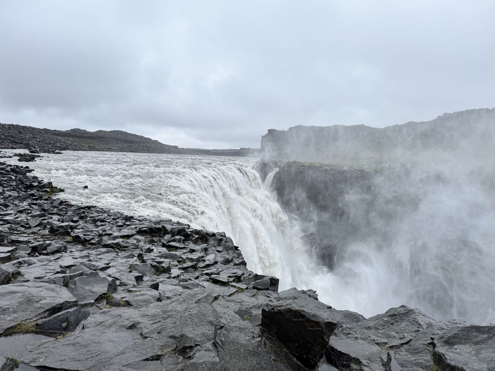
The road on the western side of Dettifoss (862) is smooth and specifically recommended for seeing the waterfall. As I hadn’t brought my radio stuff, I didn’t try to activate IS-0097 Dettifoss.
IS-0006 Hólmanes National Nature Reserve is on the Austerland. I was not sure what to expect from street view, but the spot itself was delightful. I set up on a picnic table with an easterly view of the ocean.
IS-0004 Skaftafell – Vatnajökulsþjóðgarður National Park was a great area to hike around. I took the trail up and over the falls, then to a power-generation site (where there was a geocache). After going back to the car, I set up in a field for a quick activation.
IS-0013 Dyrhólaey Nature Reserve – is an area I visited last year. At the top is a fantastic viewpoint. As I’d hit this late in the day, parking was full so I wandered down and found a nice area to pull off the side of the road and set up the table and chair.
IS-0075 Reykjanesfólkvangur Seltún Country Park was the first stop of the morning. Nearby is the Death Spa, a mud pot that’s both scalding hot and, apparently, acidic. I found a couple of picnic tables behind the fence and away from the wafting seam clouds. I tried a few more options (see below) but eventually decided to head to my evening lodging for my flight out to the Faroe Islands the next day.
There were a handful of other parks that I visited but ultimately did not activate; notes are for others:
- IS-0007 Jökulsárgljúfur – Vatnajökulsþjóðgarður National Park – did not bring my gear that day because the weather was going to be icky-poo. There are several picnic tables near parking that would work on a milder day. Dettifoss is famous for the opening minutes of Prometheus, the Alien prequel. Access is via the terrible gravel road (864) side mentioned as “forbidden for 2WD vehicles” by many rental agreements. The Subaru Forester “AWD” was fine as long as I kept it under 40kph.
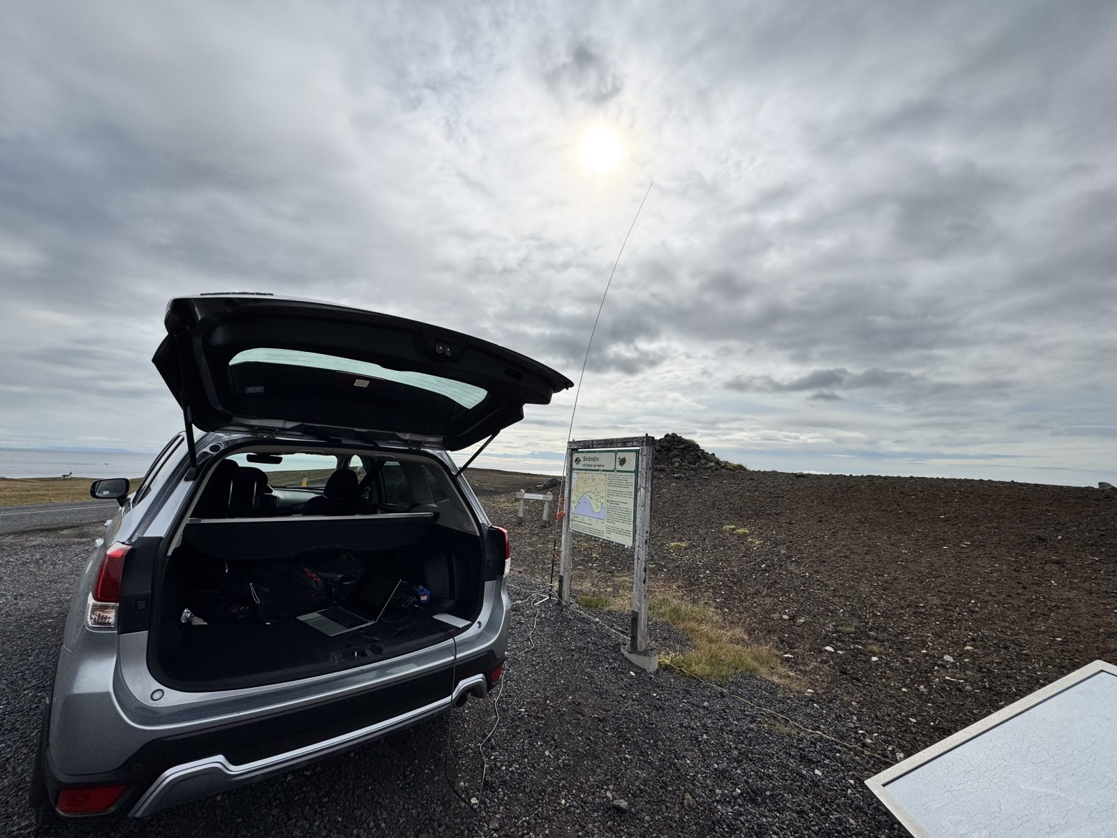
- IS-0027 Ströndin við Stapa og Hellna National Nature Reserve – park was very crowded. I could have set up in the parking lot but it would not have been a good time.
- IS-0050 Gálgahraun National Nature Reserve — It looks like one’s supposed to drive up onto the curb (in the traffic circle) to a gravel area. This would have been another “sit in the car” activation. By this point, I was getting hungry for lunch and returning the car.
- IS-0064 Garðahraun Country Park – this was a gorgeous place, babbling brook, and a nice area to set up the antenna. As soon as I had the antenna out, the mosquitos were draining my blood. Would be great in the winter.
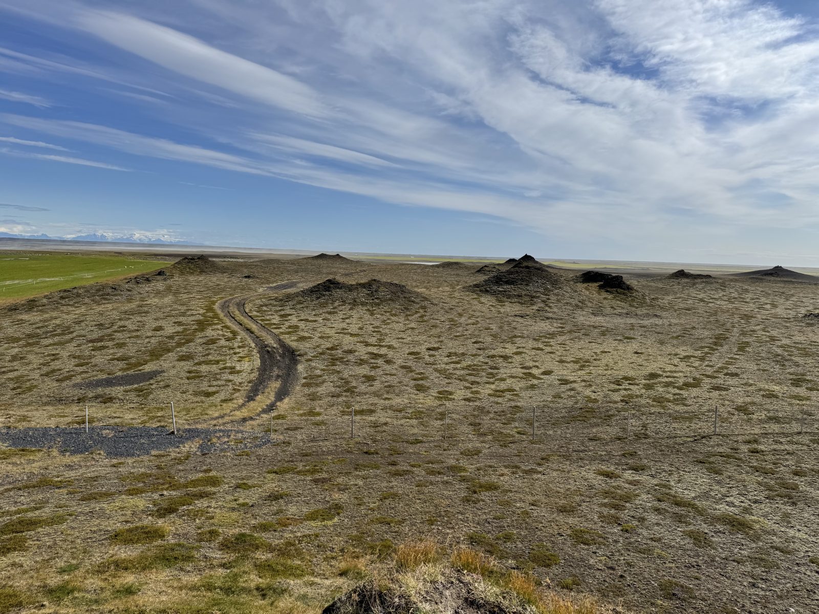
- IS-0087 Álftaversgígar Nature Monument – I spent a lot of time here trying to will the wind to abate. It’s an interesting area because the Alftaveri (large clusters of artificial craters) have protected hte area from glacial runoff from Kafta
- IS-0089 Salthöfði og Salthöfðamýrar Nature Reserve – I couldn’t figure out how to access this. From Road 1, there are a few little gravel ramps off the elevated highway, but then the actual waypoint is in the middle of untraversable (by my car) area.
- IS-0091 Teigarhorn Natural Monument – this was another really early morning visit. There was a turnout from the road, but also adjacent private property.
- IS-0100 Hverfjall National Monument – got here late in the afternoon and it was packed. Never got around to returning.
- IS-0108 Spákonufellshöfði Country Park – The posted coordinates are a cul de sac with trails to the innards of the park. Since I was here really early in the morning, on the longest travel day of my trip, I just move along.
Logging
After writing this tome, I thought I had a process worked out:
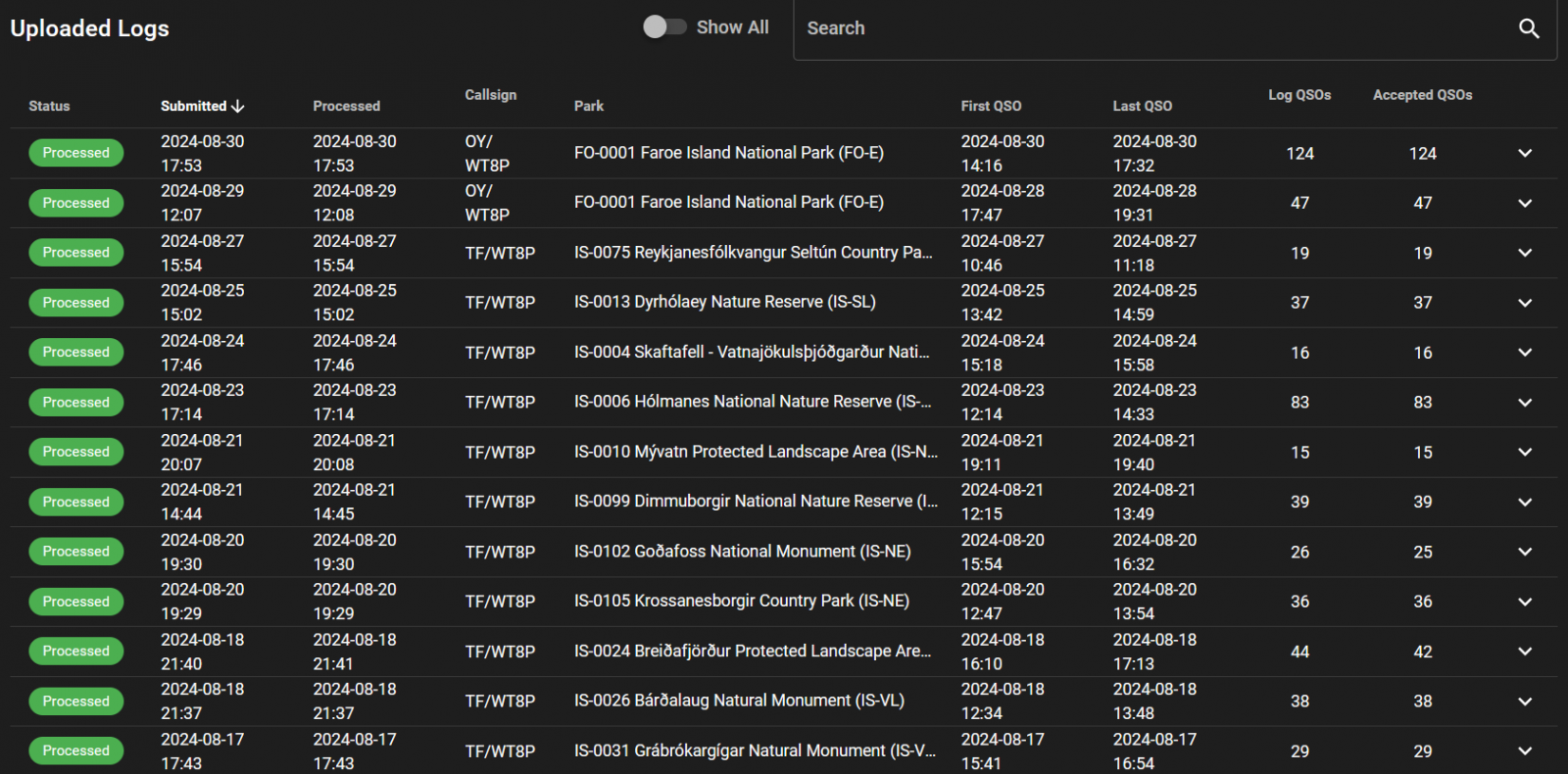
- Prepare ADIF: Combine FT8 (wsjtx_log.adi) and N1MM ADIF files into a single file with ADIFMaster. Ensure the comment had the specific park I’d be activating, grid was correct, etc.
- Upload the ADIF file to Parks on the Air.
- Define a station locations using TQSL (from the Logbook of the Web folks) to ensure the correct grid square.
- Upload the ADIF file to Logbook of the Web (LoTW).
- Upload the log to Clublog.org.
- From QRZ, import the logs from LoTW so they’d inherit the correct grid square. Problem: LoTW does not store the signal report, so my QRZ logs were lacking this element.
- Because eQSL is maddening, modify the ADIF file to hard-code the grid square IP15 to prevent logs from automatically being rejected. Hold my nose and upload to eQSL.

What else you got?
I appreciated the POTA site letting me download waypoints of the parks to try to suss out candidates. I do wish the site had an ability to “rate” parks or add notes to help other activators.
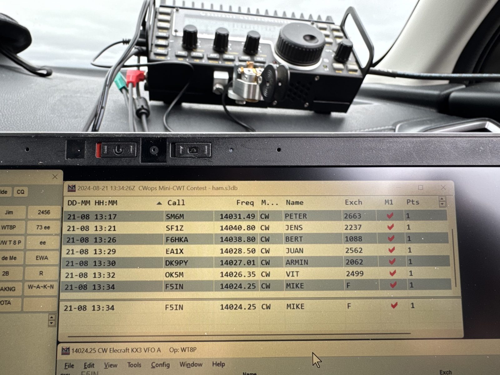
Each activation was at least an hour, limited either by degrading band conditions, weather, or my wanting to move along (and find food/toilet). I did a mix of CW and FT8 contacts, no SSB as I didn’t have a microphone. CW was the most successful during CWT because the operators are used to weird call signs and the exchange is pretty simple.
I carried my battery (because, Lithium) and my radio (in case customs needed an explanation) in my on-board bag. Each time I went through security, there was additional inspection. However, once the security officer realized it was a ham radio, there were no further issues. (Customs did not care.) If I did this again, I’d just pack it in checked baggage.